The AAPG/Datapages Combined Publications Database
AAPG Bulletin
Figure
AAPG Bulletin; Year: 2020; Issue: May DOI: 10.1306/10031919011
Return to Full Text
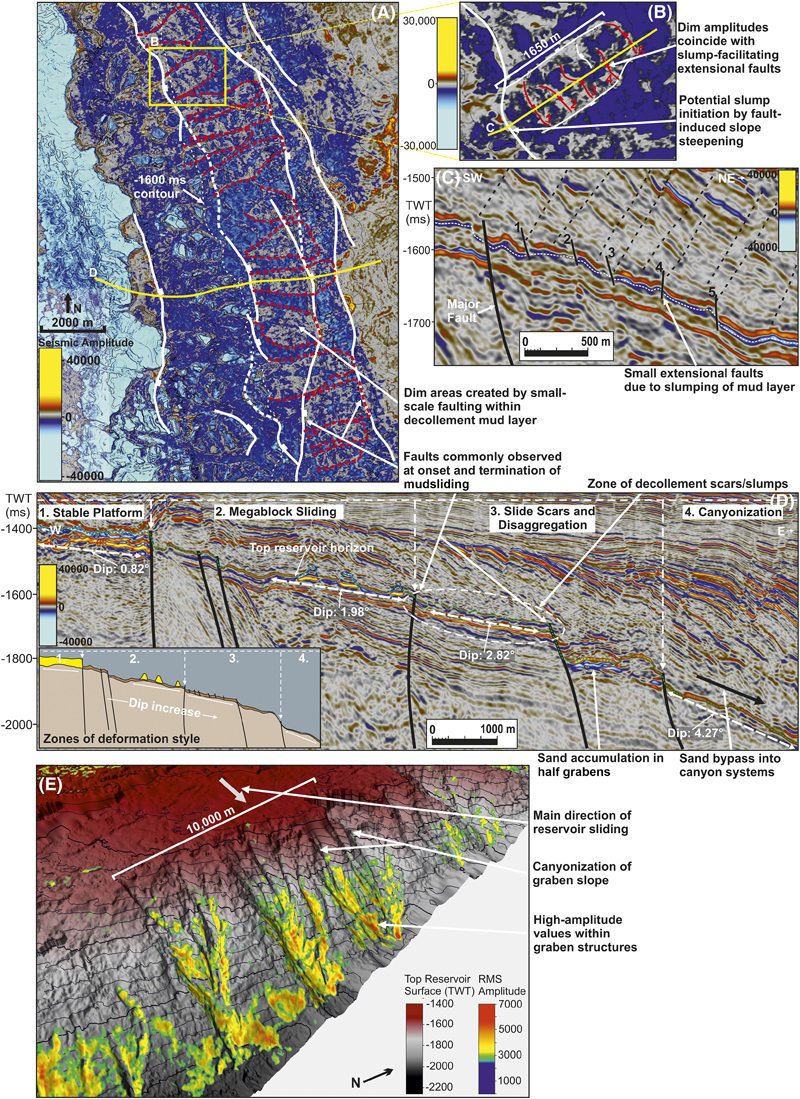
Figure 7. Seismic character transition and zones of deformation style including decollement surface slumping and canyonization. (A) A two-dimensional (2-D) aerial view of a top reservoir seismic extraction surface showing the location of low-amplitude anomalous zones and their relationship to the interpreted fault network. (B) A close-up 2-D aerial view of the top reservoir (decollement because reservoir is not present) extraction surface showing interpreted extensional faults within a low-amplitude feature. (C) A seismic section through the feature shown in (B), showing the location of small extensional faults that allow deformation of the decollement surface. (D) A seismic section showing four zones of deformation style across the reservoir and decollement surface area. The insert shows the four zones in schematic style. (E) A top reservoir two-way time (TWT)–structural surface showing slope canyonization on the eastern flank of the Melville Bay ridge. Topographically controlled shed reservoir sediment is depicted deposited within the canyons as a filtered root-mean-square (RMS) amplitude surface. The locations as seen in (A) and (E) are shown in Figure 5.
Figure 7. Seismic character transition and zones of deformation style including decollement surface slumping and canyonization. (A) A two-dimensional (2-D) aerial view of a top reservoir seismic extraction surface showing the location of low-amplitude anomalous zones and their relationship to the interpreted fault network. (B) A close-up 2-D aerial view of the top reservoir (decollement because reservoir is not present) extraction surface showing interpreted extensional faults within a low-amplitude feature. (C) A seismic section through the feature shown in (B), showing the location of small extensional faults that allow deformation of the decollement surface. (D) A seismic section showing four zones of deformation style across the reservoir and decollement surface area. The insert shows the four zones in schematic style. (E) A top reservoir two-way time (TWT)–structural surface showing slope canyonization on the eastern flank of the Melville Bay ridge. Topographically controlled shed reservoir sediment is depicted deposited within the canyons as a filtered root-mean-square (RMS) amplitude surface. The locations as seen in (A) and (E) are shown in Figure 5.