About This Item
- Full TextFull Text(subscription required)
- Pay-Per-View PurchasePay-Per-View
Purchase Options Explain
Share This Item
The AAPG/Datapages Combined Publications Database
Environmental Geosciences (DEG)
Abstract
Environmental Geosciences, V.
 2014. The American Association of Petroleum Geologists/Division of Environmental Geosciences. All rights reserved.
DOI:10.1306/eg.07311313006
Sediment study and removal of Gold Ray Dam on the Rogue River, Jackson County, Oregon
William S. Elliott Jr.,1
Eric R. Dittmer,2
Charles L. Lane,3
1University of Southern Indiana, Department of Geology and Physics, 8600 University Blvd., Evansville, Indiana 47712; [email protected]
2Southern Oregon University, Department of Environmental Studies, 1250 Siskiyou Blvd., Ashland, Oregon 97520; [email protected]
3Southern Oregon University, Department of Environmental Studies, 1250 Siskiyou Blvd., Ashland, Oregon 97520; [email protected]
AUTHORS
William S. Elliott has a Ph.D. in geology from Indiana University--Bloomington, and he is currently the Chair of the Department of Geology and Physics at the University of Southern Indiana. He is actively involved in several research projects investigating the sedimentology of mudrocks related to shale gas, impact of tectonics on climate within continental basins, and analyzing the distribution and variability of sediments in dammed reservoirs.
Eric R. Dittmer, currently Professor Emeritus Environmental Studies Department at Southern Oregon University (SOU), has Masters degrees in geology and teaching from California State University San Jo.jpgse and Southern Oregon University respectively. Prior to directing the Environmental Studies Program at SOU he was responsible for water resource planning for the Rogue Valley Council of Governments in Jackson County, Oregon. Following recent retirement he has continued to pursue his interests in water resources research and promoting seismic safety awareness.
Charles L. Lane has a Ph.D from the University of California –Los Angeles in Geology and is a Professor of Geology in the Department of Environmental Studies at Southern Oregon University. A registered geologist in both Oregon and California, his research and practice interests are in environmental geology, hydrogeology, and hydrology.
ACKNOWLEDGEMENTS
We would like to thank John Burns, Justin Huntley, and Eric Mattson of Jackson County Fire District 4 Fire & Rescue who provided boats and equipment that allowed us to conduct the SONAR study of the reservoir. We also would like to acknowledge the donation of a boat by the Jackson County Sheriff’s office that was used for the SONAR study. Many thanks to Steve Mason of HDR Engineering that provided logistical support during the SONAR survey, supplied historical photographs of Gold Ray Dam and Reservoir from the Southern Oregon Historical Society, and for discussions about the project. The sediment cores were collected by Shawn Hinz and Steve Saugen of Gravity Consulting. The manuscript benefited from thoughtful reviews by Jennifer Bountry and David M. Bush, as well as editorial input from Kristen Carter. Finally, we would like to acknowledge Rich Ugland for his assistance with the SONAR study, and the former undergraduate students at Southern Oregon University that were involved with the project: Jon Anderson, Emily Bray-Nash, Elizabeth Carrington, and Brandon Lambert.
ABSTRACT
SONAR, historical and aerial photographs, and vibracoring were used to assess the type and thickness distribution of sediments impounded by Gold Ray Dam on the Rogue River in southern Oregon. From these data, a volume of about 400,000 cubic yards ( ) of sediment was determined for the inundated area of the reservoir.
Overall, sediment volumes in the impounded part of the reservoir were less than expected. There are three possibilities that may explain the perceived absence of sediment: (1) the gradient of the Rogue River in this stretch is less, and therefore sediment yields are less; (2) the extraction of gravels and/or other impediments upstream decreased the availability of sediments delivered into the reservoir; and/or (3) sediment was deposited by a prograding delta that filled in the inundated area of the floodplain upstream from Gold Ray Dam. The amount of sediment deposited on this inundated floodplain may have been as much as 1,800,000 cubic yards ( ), bringing the total amount of sediment impounded by Gold Ray Dam to
  yards (
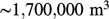 ).
).
Applied sedimentology is not only vital to developing a depositional model for the filling of a reservoir, but also providing insights into depositional and erosional changes that will occur upon the removal of a dam. In particular, the processes of delta formation, reoccupation of abandoned channels, and avulsion are paramount in determining sediment accumulation and distribution in reservoirs.
Pay-Per-View Purchase Options
The article is available through a document delivery service. Explain these Purchase Options.
| Watermarked PDF Document: $14 | |
| Open PDF Document: $24 |