About This Item
- Full text of this item is not available.
- Abstract PDFAbstract PDF(no subscription required)
Share This Item
The AAPG/Datapages Combined Publications Database
Southeast Asia Petroleum Exploration Society (SEAPEX)
Abstract
Abstract: Characterization of Submarine Catastrophic Events - Reservoir or Seal?
The deep marine sediments deposited Offshore Borneo are characterized by large scale submarine landslides, which have been well documented in the literature. The deposits of the landslides are known as Mass transport complexes (MTC) or Mass Transport Deposits (MTD’s) and provide valuable information on sediment dispersal patterns, paleoslope and reservoir development. They are significant when reservoir sands are devoid of any indication of paleocurrent direction and where seismic data quality is poor. Often MTC’s are considered reservoir seals but sediment mixing of clastic and organic material combined with multiple shear failure and immense lateral coverage could produce the porosity and permeability necessary to form an extensive reservoir.
GEOLOGICAL SETTING
The Northwest Borneo margin and the NW Borneo Trough are related to the opening of the South China Sea. The proto-South China Sea was subducted beneath the Sunda Shelf during the Late Cretaceous times. The cessation of subduction occurred in the Miocene, where large blocks of continental shelf blocked the Subduction trench. Subsequent collision, between the leading edge of the South China Sea continental realm with the Crocker-Rajang accretionary margin of Northwest Borneo caused the uplift and erosion of this accretionary margin, providing abundant sediment supply to form the Baram Delta.
MODERN SHELF
The modern-day shelf is 50-70 km wide and characterized by the Baram River and delta system connected via a canyon to the NW Borneo Trough. A steep sided escarpment rises 1 km from the basin floor separating the shelf margin from the trough. The seafloor morphology is defined by elongate mini basins parallel to the coastline, separated by shale-cored ridges. Observed on the modern basin floor are giant submarine landslides. The size of these slides (volume 1200 km3, covering an area 5300 km2 with a thickness of approximately 240 m) are some of the largest ever observed. These features are commonly observed subsurface, recurrent through geological time and are thought to be a result of a combination of sea level change, a tectonically active margin and the large sediment supply from the Baram Delta.
INTERNAL SEISMIC TEXTURES
The deep marine sediments offshore Borneo are predominantly deposited during long periods of quiescent sedimentation with thick bodies of conformable mudstone, characterized by consistent structural dip, intermingled with sheet sands and sporadic debris flows. However, interspersed in this uniform sedimentary environment, is massive structural failure and catastrophic events, causing slides, slumps and debris flows, followed by post depositional creep. The catastrophic events are often followed by thick structureless sandstones.
Three main types of seismic characteristics are observed: 1) one where coherent surfaces are observed within the unit; 2) where the beds are coherent but deformed plastically; and 3) where there are no coherent surfaces observed. The first two types appear to be related to sediment creep, slide and slumping, whereas the third appears to be related to a large slurry event.
INTERNAL IMAGE TEXTURES
Three distinctive dip patterns are observed within the Mass transport Deposits:
-
Slides
-
Landslides are mass movements of sediment above a plane of shear failure and are characterized by a stratigraphic order and close proximity to its initial failure. The dips in the sediment are seen to have a high angled base, and a decrease in dip magnitude away from the shear failure. The dip azimuths tend to be parallel with the structural dip. They are commonly less than 10-100 m thick and enclosed in coherent sediment, although obviously these features could be much larger.
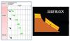 Figure 1. Characteristic Dip Patterns in slides (Dark green tadpoles indicate structural dip and the light green tadpoles indicate deformed beds)
-
Slump
-
A slump occurs above a basal/lateral shear plane and is characterized by recognizable surfaces often deformed. This type of dip pattern is characterized by an increase in dip magnitude, as the sediments over steepen, followed by a reduction in dip inclination above the fold axis (Figure 2). There is a sharp basal surface to the unit, and the dip azimuth can be orientated either parallel or opposing the structural dip.
![]() Figure 2. Characteristic dip patterns of over steepening beds. (Dark green tadpoles indicate structural dip and the light green tadpoles indicate deformed beds). The internal structure of the fold is very well manifested on the dip data orientations as seen in the sketch (centre). An outcrop picture (right) from Tabernas Basin in Spain is used to simulate and visualize the case.
Figure 2. Characteristic dip patterns of over steepening beds. (Dark green tadpoles indicate structural dip and the light green tadpoles indicate deformed beds). The internal structure of the fold is very well manifested on the dip data orientations as seen in the sketch (centre). An outcrop picture (right) from Tabernas Basin in Spain is used to simulate and visualize the case.
-
Debris flows (megabeds and small debris flows)
-
Debris flows are slurry-like flowing aggregates, with plastic-like yield strength which freeze on deposition. The size of these units can range from 1 m to over 100 m thick. The thick units appear to stack multiple dips to form a zigzagging dip pattern. The thick units are clearly seen on a seismic scale and seem to form undulating chaotic seismic horizons. Thick sand bodies have been observed overlaying these large mega beds and often enveloped within the mudstones. This type of megabed could form a potential reservoir.
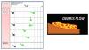 Figure 3. Characteristic Dip patterns in Debris flows (megabeds) (Dark green tadpoles indicate structural dip and the light green tadpoles indicate deformed beds). The features can be over 100 m thick, and thus observed on seismic
Acknowledgments and Associated Footnotes
1 M. Johansson: Geode-Energy Ltd, UK; [email protected]
Copyright © 2019 by Southeast Asia Petroleum Exploration Society (SEAPEX)