The AAPG/Datapages Combined Publications Database
AAPG Bulletin
Figure
AAPG Bulletin; Year: 2020; Issue: May DOI: 10.1306/10031919011
Return to Full Text
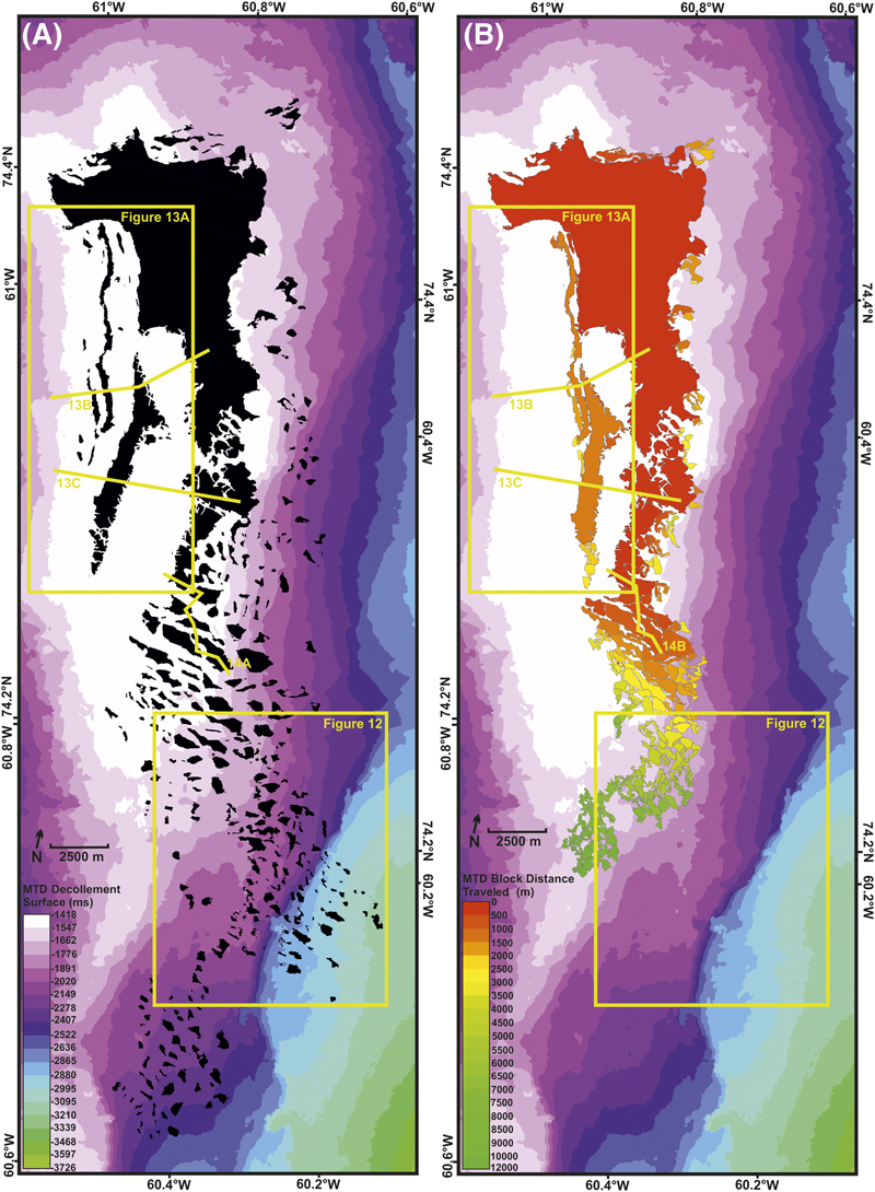
Figure 10. Landslide reconstruction. (A) A two-way time–structure map of the decollement surface overlaid by black polygons representing the modern-day location of individual reservoir blocks that are in excess of 30 ms (∼25-m [∼82-ft]) thickness. The locations for Figures 12; 13A–C; and 14A are shown. (B) A two-way time–structure map of the decollement surface (legend within (A)) overlaid by polygons representing the reconstructed location of individual reservoir blocks in their presecondary sliding location. Each polygon is colored by the total distance traveled according to reconstruction. The locations for Figures 12; 13A–C; and 14B are shown. MTD = mass transport deposit.
Figure 10. Landslide reconstruction. (A) A two-way time–structure map of the decollement surface overlaid by black polygons representing the modern-day location of individual reservoir blocks that are in excess of 30 ms (∼25-m [∼82-ft]) thickness. The locations for Figures 12; 13A–C; and 14A are shown. (B) A two-way time–structure map of the decollement surface (legend within (A)) overlaid by polygons representing the reconstructed location of individual reservoir blocks in their presecondary sliding location. Each polygon is colored by the total distance traveled according to reconstruction. The locations for Figures 12; 13A–C; and 14B are shown. MTD = mass transport deposit.