The AAPG/Datapages Combined Publications Database
AAPG Bulletin
Figure
AAPG Bulletin; Year: 2020; Issue: May DOI: 10.1306/10031919011
Return to Full Text

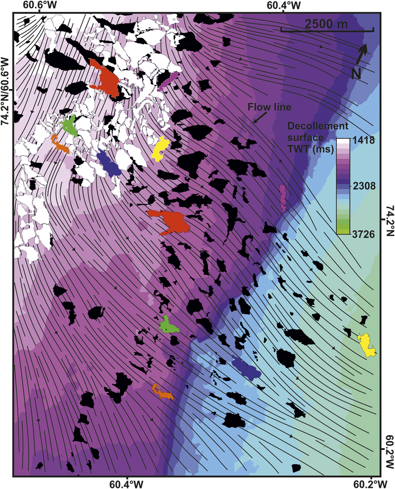
Figure 12. A two-way time (TWT)–structure map of the decollement surface overlaid by polygons representing the modern-day location (black) and reconstructed location (white) of the reservoir blocks. Certain polygon pairs have been colored for comparison. Flow lines are shown between block polygon pair locations that represent the direction of movement and highlight a bidirectional trend during sliding. The map location and decollement surface legend are shown in Figure 10.

Figure 12. A two-way time (TWT)–structure map of the decollement surface overlaid by polygons representing the modern-day location (black) and reconstructed location (white) of the reservoir blocks. Certain polygon pairs have been colored for comparison. Flow lines are shown between block polygon pair locations that represent the direction of movement and highlight a bidirectional trend during sliding. The map location and decollement surface legend are shown in Figure 10.