The AAPG/Datapages Combined Publications Database
Environmental Geosciences (DEG)
Figure
Environmental Geosciences (DEG); Year: 2017; Issue: December DOI: 10.1306/eg.07071717001
Return to Full Text

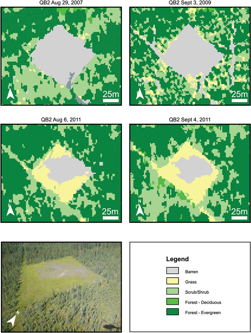
Figure 5. Time series of satellite-derived land-cover classification for Aspen area of interest well pad 07-23-93-7 accompanied by helicopter photography from 2011 (lower left). Vegetation encroachment is apparent from 2007 to 2011. Within the buffer zones of the two images from 2011, apparent differences in “scrub/shrub” cover are likely a relic of the difference in image off-nadir acquisition angle (QuickBird-2 [QB2]: 19.11° and WorldView-2 [WV2]: 9.92°). This relic is more apparent on a larger scale where north–south-oriented seismic lines are apparent or obscured, depending.

Figure 5. Time series of satellite-derived land-cover classification for Aspen area of interest well pad 07-23-93-7 accompanied by helicopter photography from 2011 (lower left). Vegetation encroachment is apparent from 2007 to 2011. Within the buffer zones of the two images from 2011, apparent differences in “scrub/shrub” cover are likely a relic of the difference in image off-nadir acquisition angle (QuickBird-2 [QB2]: 19.11° and WorldView-2 [WV2]: 9.92°). This relic is more apparent on a larger scale where north–south-oriented seismic lines are apparent or obscured, depending.