The AAPG/Datapages Combined Publications Database
Environmental Geosciences (DEG)
Figure
Environmental Geosciences (DEG); Year: 2017; Issue: December DOI: 10.1306/eg.07071717001
Return to Full Text
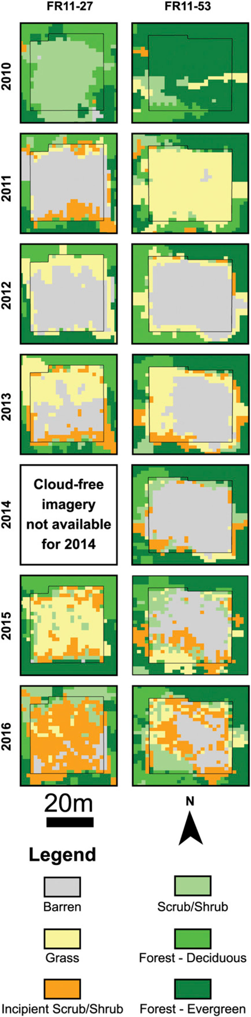
Figure 8. Time-series satellite-derived land-cover classification for two well pads within the Firebag areas of interest. Note that the land-cover legend appears at the bottom of the figure. FR-11-29 (left panels) and FR-11-53 (right panels) are representative relatively rapid and relatively slow revegetation observed across this area of interest, respectively. The 2010 land-cover classification represents the well pads prior to disturbance, 2012 data represent the well pads 2 yr after disturbance, and the 2016 land-cover classification represents the well pads 6 yr after disturbance.
Figure 8. Time-series satellite-derived land-cover classification for two well pads within the Firebag areas of interest. Note that the land-cover legend appears at the bottom of the figure. FR-11-29 (left panels) and FR-11-53 (right panels) are representative relatively rapid and relatively slow revegetation observed across this area of interest, respectively. The 2010 land-cover classification represents the well pads prior to disturbance, 2012 data represent the well pads 2 yr after disturbance, and the 2016 land-cover classification represents the well pads 6 yr after disturbance.