The AAPG/Datapages Combined Publications Database
Environmental Geosciences (DEG)
Figure
Environmental Geosciences (DEG); Year: 2019; Issue: September DOI: 10.1306/eg.02271918009
Return to Full Text
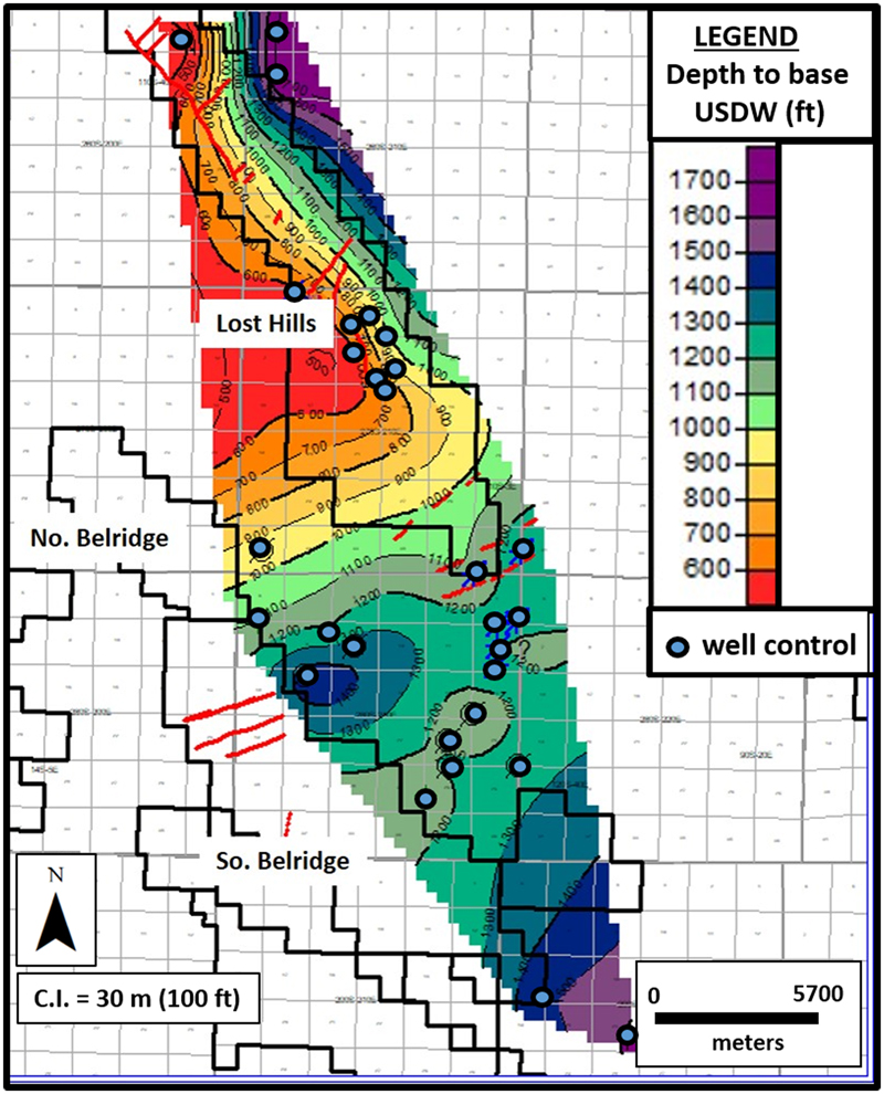
Figure 7. Map showing depth to base of underground sources of drinking water (USDW) (total dissolved solids = 10,000 mg/L) based on log analysis. Red lines indicate faults (Young, 1968; California Division of Oil Gas and Geothermal Resources, 1998). Black lines are oil field administrative boundaries. Wells shown as blue dots are those used to determine the base of USDW. Depth values in feet. C.I. = contour interval; No. = North; So. = South.
Figure 7. Map showing depth to base of underground sources of drinking water (USDW) (total dissolved solids = 10,000 mg/L) based on log analysis. Red lines indicate faults (Young, 1968; California Division of Oil Gas and Geothermal Resources, 1998). Black lines are oil field administrative boundaries. Wells shown as blue dots are those used to determine the base of USDW. Depth values in feet. C.I. = contour interval; No. = North; So. = South.