The AAPG/Datapages Combined Publications Database
AAPG Bulletin
Figure
AAPG Bulletin; Year: 2021; Issue: August DOI: 10.1306/02262118214
Return to Full Text
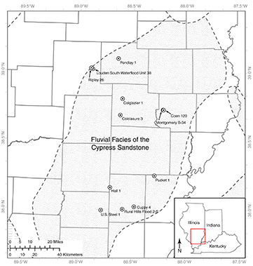
Figure 1.
Location map of the study area within the Illinois Basin showing the extent of the Cypress Sandstone. The stippled area in southcentral Illinois is the relative location of the fluvial facies of the Cypress. Wells sampled for microporosity analysis are shown with black dots. Figure modified from Nelson et al. (2002). ©2002 University of Illinois Board of Trustees. Used with permission from the Illinois State Geological Survey.
Figure 1. Location map of the study area within the Illinois Basin showing the extent of the Cypress Sandstone. The stippled area in southcentral Illinois is the relative location of the fluvial facies of the Cypress. Wells sampled for microporosity analysis are shown with black dots. Figure modified from Nelson et al. (2002). ©2002 University of Illinois Board of Trustees. Used with permission from the Illinois State Geological Survey.