The AAPG/Datapages Combined Publications Database
AAPG Bulletin
Figure
AAPG Bulletin; Year: 2015; Issue: May DOI: 10.1306/10231414089
Return to Full Text
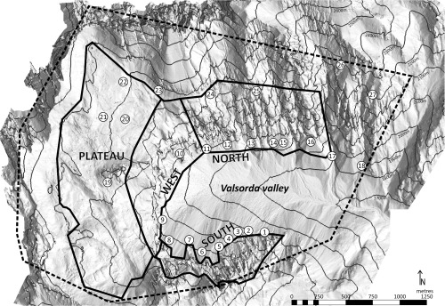
Figure 2
Overview of the digital outcrop model (DOM). The part of the DOM obtained by helicopter LIDAR scanning is indicated by solid black lines. It is subdivided into four zones that are smaller and easier to manipulate. The rest of the DOM is acquired from the digital terrain model (DTM). The outlines of the reservoir model are indicated by the dashed line. Sample sections are marked by their section number.
Figure 2 Overview of the digital outcrop model (DOM). The part of the DOM obtained by helicopter LIDAR scanning is indicated by solid black lines. It is subdivided into four zones that are smaller and easier to manipulate. The rest of the DOM is acquired from the digital terrain model (DTM). The outlines of the reservoir model are indicated by the dashed line. Sample sections are marked by their section number.